2.50.86
21-Jun-2018
|
•Modification:
Solved in this version: Due to an issue in "Sense April 2018", NPGeoMap Popup Variables weren't created automatically anymore.
•
Modification:
From this version on NPGeoMap for Sense 2.5 and NPGeoMap for Sense 3.1 can be used parallel.
|
2.50.84
07-Dez-2017
|
• New Feature - Reverse Geocoding for Radial Spheres: New Feature - Reverse Geocoding for Radial Spheres:
Instead of geocoding coordinates out of an address, this feature reverse geocodes the coordinates of a sphere center point and returns the address to NPGeoMap HashtagVariables. Those can be set inside a popup to show the address of the spheres center point by click.
(Here ID required!) •New Feature - Mastermap:
You can set the ID of another map object that functions as source for the map position of the map. As soon as the Mastermap changes the position, for example because of a selection, the map where the ID is set will be adapted. •New Feature - alternative path for map files:
This feature inside Expert Settings allows to store map files in a customized place, even on an external server. Map files in NPGeoMap are loaded from the path you set here. • Extended Feature - new NPG-Variables for Spheres:
Some new NPGeoMap-Hashtag-Variables where added inside RadialSpheres Settings, regarding the coordinates of the Sphere center.
Coordinates can be displayed, converted with a respective EPSG Code or "reverse geocoded" to show the adress.
To enrich the PopUps you may now integrate for example GoogleMaps Streetview or GoogleMaps Routing.
(GoogleMaps key required!) • Extended Feature - new NPG-Variables for Markers:
Three new NPGeoMap-Hashtag-Variables where added for usage in Dynamic Marker Settings, Dynamic Endmarker Settings and Simple Marker Settings, to enrich PopUps with coordinates information and integrate for example GoogleMaps Streetview.
(GoogleMaps key required!) •Extended Feature - new Zoom Layers:
A new Zoom Layer has been added inside Zoom Settings:
"Radial Spheres" •Extended Feature - CenterPoint:
A new option was added for setting the "CenterPoint" inside Zoom Level Definition - now several points (separated by semicolon) can be added to create kind of a Center Area instead of just one Center Point. •Extended Feature - "markerinpolygons":
The feature markerinpolygons has now an additional setting markerinpolygonsuniqeuassign inside the Extended Settings. It defines if a Marker on two or more overlapping Polygons is assigned uniquely to one Polygon or to each of them.
•Extended Feature - Help Button:
The kind of Manual can now be set inside Expert Settings:
"helptype": 0 = Online Help, 1 = PDF Offline Help
When clicking on the Help-Button either a website (online manual) or a Pdf document (offline manual) will be opened.
 •Extended Feature - new Zoom Layers:
Two new Zoom Layers where added inside Zoom Settings:
"Dynamic Marker" and "Dynamic Lines" (Previous "Dynamic Markers" is now "Dynamic Markers, Lines, Radials")
Now Lines and Markers can be called and focused separately. •Extended Feature - new NPG-Variables:
Some new NPGeoMap-Hashtag-Variables where added inside RadialSpheres Settings, regarding the coordinates of the Sphere center. •Server:
NPGeoMap now supports ESRI ArcGIS Server Multi Layer. •Modification:
Since Qlik Sense deletes values inside a text containing "${}", the default value for the Local Tileserver Path has been changed from "${Z}" to "@{Z}".
(Important when using ESRI TileServers) •Modification:
Since the internal Qlik Sense Colorpicker doesn't work anymore, NPGeoMap now provides a text dropdown field with all default Sense colors. This applies only for static color settings, like for example the color of a static map. •Bugfix:
If the map was set "directly" inside SimpleMap Settings, it possibly happened that Polygons where loaded twice.
This was fixed with version 2.5.84. |
2.50.75
|
• New Feature - Marker Order sequence by Expression:
Markers can now be sorted via the Expertsettings ordermarkerexpression using a QlikSense formula.
Therefore it is possible with superimposed markers, to control which markers are first or last drawn. |
2.50.74
25-April-2017
|
•New Feature - Google Maps "Channel" Parameter:
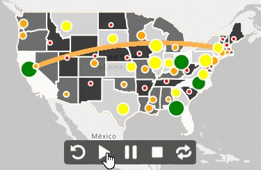
For Google Maps, the parameter "channel" can be set in the Extended Map Settings , so the usage of the Google Maps API can be evaluated via the Google Maps API Console per application. • New Feature - Save Radials and Isochrones:
Radial Spheres and Isochrones are calculated at run time, and now it is possible to save the displayed areas as NPGP map and load them as polygons (Dynamic Maps or Simple Maps).
You can save the spheres by click on the new menu button in the Radials menu:
 •New Feature - Simple Maps and Simple Marker Label Size:
For simple maps and simple markers, the label size can now be set separately for each Simple Group. •New Feature - Simple Maps and Simple Marker Label Color:
For simple maps and simple markers, the label color can now be set separately for each Simple Group. |
2.50.72
30-Mar-2017
|
•New Feature - Dynamic Map KPI:
KPI (Key Performance Indicator) feature now as well for Dynamic Maps.
The values are used by Radial Spheres and Isochrones - inside a PopUp the summarized values of the respective Polygons can be displayed (e.g. the total KPI of all districts inside the Sphere).
Therefore two new NPGeoMap #Hashtag Variables have been added: [#PolygonKPI] and [#PolygonCount] (to be set inside the PopUp definition). •Extended Feature - Sphere Selections:
Radial Spheres and Isochrones can now be used as a selection tool for Polygons as well (previously only for Markers).
Therefore a new selection type "3" was added inside the Radial Spheres and Isochrones settings
and a new feature intersect, which defines if a Polygon that is not completely inside the Sphere will be count as well, or not. • Modification:
The selection performance for Polygons has been increased. •Bugfix:
When setting Hexagon ClusterSource to "S" (only StartMarkers), the first Simple Marker Block has been added to the calculation as well.
This was fixed with version 2.50.72. |
2.50.71
08-Mar-2017
|
•New Feature - Bending Lines:
A new Line Type was added: "Bending Lines" (Line Type = 6).
The bending angle can be freely adjusted - positive values always bend clockwise, negative values counterclockwise.
See more details in the Line Settings. •New Feature - Dynamic Marker Border Width:
Border width can now be set for Dynamic Markers and Dynamic Endmarkers. •Modification of default Maps:
All default Maps for Germany have been updated and one was added:
DE_0.geo (Country)
DE_1.geo (Bundesländer)
DE_2.geo (Bezirke)
DE_3.geo (Kreise) - new! •Bugfix:
An error message occurred when Dynamic Startmarker and Endmarker were identical.
This was fixed with version 2.50.71. |
 click to expand |
2.50.69
06-Feb-2017
|
This NPGeoMap Version is compatible with Sense 3.2
•Additional Feature - Server Map Caching:
The Caching Feature for Maps on a Server (Expert Settings) may now be restricted to a specified duration.
After a defined amount of days the Cache will be cleared automatically and all required Maps will be reloaded. •Modification of default Maps:
Map file "US_1.geo": American Samoa and Puerto Rico have been removed.
Map file "WORLD_0.geo": NZ, FJ and KI have been adjusted due to crossing the date line. •Modification:
The Marker projection setting proj4definition inside the Expert Settings takes no longer effect on Paths.
Paths are now always interpreted in WGS84. •Change:
The default value of the doubleclickspeed has been changed from 255 (Windows standard) to 400 milliseconds. |
2.50.67
09-Dec-2016
|
• New Feature - NPGeoMap DESIGNER:
Try out our new Designer to set the properties of your NPGeoMap application fast and easy!
The NPGeoMap Designer is available inside Sense Edit mode (button in the middle of the object) as well as outside of it (grey gearwheel in the lower right corner of the map, visible when moving the cursor). You may even switch between using the Designer or the Properties Menu - it's all synchronized and works well together. You will see, the handling is very structured but intuitiv at the same time! Just have a look and convince yourself...
(Currently the following settings are not integrated yet: Simple Maps and Markers, Static Maps and Markers, edit/change Classes, Radial Spheres & Isochrones, Zoom Areas) • New Feature - Polylines:
Dynamic Markers now support Polylines in the coordinates feature Path. It even allows to set Polygon or Map coordinates - for instance the column "COORDINATES" in NPGeoMap maps can be set there. In this way Maps are handled like Lines.
Polylines are especially used for floorplans and layouts, construction outlines or technical drawings.
They can be configured just like other Lines and Paths inside the Dynamic Markers Line and Path Settings. •New Feature - Server Map Caching:
The new feature "savecachedmapsfromserver" in the Expert Settings allows to turn off the saving of maps cached from the server in NPGeoMap for better performance.
(This can be helpful in case the browser memory is limited and quite small.) •Additional Features - Animation:
Two more features where added for Animations: oThe Animation Menu Bar may be hidden/disabled now in the feature "animationplaybar" inside the Menu Settings (Expert Settings). (0 = menu disabled, 1 = menu enabled) oAn additional status "3" is now available for the feature "activation" inside the Animation Settings (Expert Settings). When set, the Animation starts automatically, but only once when the app or the sheet is opened or refreshed. •Modification World Map:
The map "World_0.npgp" (included in NPGeoMap Extension) is renewed - Polygons crossing date line where adjusted. •Modification:
MouseOvers are now enabled and supported on touchscreen devices. •Modification:
The info boxes of Tooltips (MouseOvers) and the sketchboxes (when selecting areas on the map) are now even more flexible and change position and measures dynamically with mouse cursor movement. •Modification:
If no Background Map is set (like GoogleMaps or other Tile Maps), the zoom level is no longer restricted since version 2.5.65 - now no longer endlessly but till zoom level 46, due to OpenLayers conditions. •Information - Sense Mashups:
In certain circumstances there might have been error massages in Sense Mashups and the extension hasn't been loaded correctly. The subfolder structure in Mashups is now considered. |
2.50.65
22-Nov-2016
|
•New Feature - Simple Map Order:
Each Simple Map Block has now an additional feature "order", which allows to sort the Simple Maps by number (numeric values). The smallest number will be displayed as top layer, the lowest as bottom layer. (If not set, the layers are displayed in the order, in which the Simple Map Blocks themselves are arranged inside the dialog of the expression editor.) •Additional Default Map - USA:
A new Map was added to the default Map Set: "US_2.geo" The map shows all Counties of the United States.
All other US maps have been updated: "US_0.geo" (Country border) and "US_1.geo" (States). •Modification:
If no Background Map is set (like GoogleMaps or other Tile Maps), the zoom level is now no longer restricted - this means you can zoom in endlessly. |
2.50.63
15-Nov-2016
|
• New Feature - Animations:
Objects in NPGeoMap can now be animated. You can define which Objects are animated, in which way (effect) they are animated and in which order. With a special menu bar you can control the animation to pause or repeat it.
Set the animation properties in the Expert Settings and the animation order for Dynamic Markers, Dynamic Endmarkers, Lines and Dynamic Maps in their respective settings (Static objects can only be animated in an automatic order).
Available animation effects:
Fade in, fly in, scale in, pulse, scale in 360 and follow path (for Lines and Paths) - see more in Expert Settings. |
|
•New Feature - Mapbox "access token" and "style URL" support:
The Tile Server Provider Mapbox makes it possible to create and edit Background Maps the way you want them to look. Therefore two more features are now inside the Map Settings.
Just sign up at Mapbox and have a quick look on our Tutorial How to get a Mapbox Access Token at the NPGeoMap website. •Information - Mapbox:
"Mapbox Editor projects will become read-only on January 31st. You can now export GeoJSON and KML from your Mapbox Editor projects on this page and we recommend transitioning to the new dataset editor." - Mapbox on 11-11-2016
Have a look at mapbox.com/studio/classic/projects/ •New Background Map - OpenStreetMaps Grey:
There's a new Background Map available in Basic Settings  Maptype "OpenStreetMaps Grey". Maptype "OpenStreetMaps Grey".
It's basically the regular OSM Map, but converted in grayscale. The internal type for this map is "17". • New Feature - two directions for GreatCircles:
A new setting section in the Line Settings (part of Dynamic Marker Settings) allows to configure a "To-" and a "From/Back direction" in one GreatCircle. In this way it is possible to display different Line styles, MouseOvers (Tooltips) and PopUps for each direction, without setting two separate Lines. Moreover, the system automatically detects the exact center, based on the actual geographical distance of the GreatCircle. •New Feature - relative Note position:
The position of Notes is now more flexible. Relative to their related Markers or Polygons they can be rendered in all directions (up, down, left, right) or even perfectly centered.
Notes and Note positions can be configured for Dynamic Markers, Dynamic Endmarkers and Dynamic Maps. •Additional Feature - new Line Types:
There are two more Line Types available for Dynamic Markers - "Beatle Lines" (type = 4) and "Swing Lines" (type = 4) •New Feature - Line Arrow Styles:
You can now change the predefined style for Arrows by drawing simple shapes with graphical SVG coordinates in the Expert Settings.
Arrows are displayed on Lines and Paths. •New Feature - SVG images:
Instead of setting an image file you can use SVG to draw a image on the fly. In this way you can use Qlik Sense Fields, Formulas and Variables to draw images with dynamic content.
This feature is enabled for Dynamic Marker Images, Dynamic Endmarker Images and Dynamic Polygon Images. |
2.50.57
|
• New Feature - Simple Map coordinates via map files:
Just like the "Source" of Dynamic or Static Maps, Simple Maps now also may get their coordinates directly out of a map file, instead of loading them in the Sense script.
Therefore instead of entering the Sense fields containing the coordinates, just fill in the name of the respective map file.
Major advantage is increased performance of apps in network operation, since the amount of coordinates doesn't have to be loaded via the script as well. •New Feature - GeoMakePoint:
NPGeoMap now supports the usage of the Sense coordinates format GeoMakePoint [lon, lat] - the respective Sense fields may be used just as they are. •Modification:
File calls are now handled via relative paths in Sense. This is necessary especially when using Virtual Proxy Servers, to get the correct path. •Information:
Instead of the internal Sense image path
"/QvAjaxZfc/QvsViewClient.aspx?public=only&name=Extensions/NPGeoMapSense_v2.50/images\[...]"
only
"../Extensions/NPGeoMapSense_v2.50/images/[...]"
can be used, to access local saved images (for example in PopUps or MouseOvers). |
2.50.54
|
•New Feature - parallel open PopUps:
Several PopUps now may be kept open at the same time.
The new feature "popupautoclose" in the Expert Settings provides an automatically closing of a PopUp, as soon as another one is opened. By disabling this feature, any number of PopUps may be open at the same time. •Change:
The NPGeoMap class ".Nav" in the CSS file "menu.css" was renamed into "ecNav", due to intersections with some Bootstrap classes. |
2.50.53
|
• Additional Feature - Cluster Source:
Source for automatically calculating Colors and Sizes of Circle Cluster or Hexagon Grid Cluster may be now also KPI values.
This refers to the KPI settings of Dynamic Markers, Dynamic Endmarkers or of Simple Marker blocks. •Bugfix:
An error message occurred when setting more Labels than values in NPGeoMap Charts.
This was fixed with version 2.50.23 - surplus Labels won't be displayed anymore.
That concerns:
ImageCharts and PopupCharts of Dynamic Markers,
ImageCharts and PopupCharts of Dynamic Endmarkers and
ImageCharts and PopupCharts of Dynamic Maps. •Bugfix:
The font-weight feature of Simple Marker Labels was invers (default was bold and setting bold displayed Labels normal).
This was fixed with version 2.50.23. |
2.50.52
|
•Attention changed GoogleMaps APIs:
As of June 22nd, 2016 GoogleMaps no longer supports keyless access - Google Announcement
Therefore an API key has to be set in all NPGeoMap applications using GoogleMaps. If you already have an API key, just enter the key in the EXTENDED MAP SETTINGS.
If not, have a look at our Tutorial at NPGeoMap Website for getting a GoogleMaps key. • New Feature - Custom Defaults:
Since now all NPGeoMap apps using GoogleMaps have to use an API key (see above), there's a new way to deposit and set this key globally as a default value for all objects. Doing so the key is stored within a file in the NPGeoMap Extension directory - learn more in Map Settings.
Currently this feature only provides the settings of Google, Here, Bing and Mapbox. • New Feature - CSS for PopUps, MouseOvers und SketchBoxes:
Similar to the map key defaults (see above), the CSS file "info.css" in the NPGeoMap Extension Directory (sub folder "css") can be configured to create customized default presentation of PopUps, MouseOvers and SketchBoxes (displayed information when drawing marking areas for taking selections).
•Information on Sense Mashups:
Using Mashups in NPGeoMap requires at least jQuery 2.1. The automatically created Masups in Sense DevHub use an older jQuery version, what leads to problems with displaying NPGeoMap objects. This has to be corrected within the HTML Mashup file. |
2.50.50
|
• New Feature - Isochrones:
Due to the new Tile Map provider HERE (see further below) so called Isochrones can now be configured.
An Isochrone is a perimeter out of points around a center which all can be reached either in the same time or within the same amount of kilometers/miles on roads. Therefore it creates realistic catchment areas. In contrast Radial Spheres just show a circuit in beeline distance.
Isochrones have access to the same range of features as Radial Spheres.
Details in chapter Radial Spheres. •New for Radial Spheres and Isochrones: oRadial Spheres as well as Isochrones may now be displayed with a fill color and therefore as an area. This affects the "clickability" - details here. oCentral Image for Spheres oSetting central Images in combination with zero "distance" (radius), Pins can be created and set manually anywhere on the map using the Spheres Menu - details here. |
 click to expand |
• New Feature - Hexagon Grid Cluster:
Hexagon Grid Cluster (also called "Hexbinning") is a innovative way to display big data meaningful and analyzable.
A grid of Hexagons created automatically at runtime displays information about the "clustered" Markers beneath - either their amount or the Hexagons can even sum up their values/KPIs. The returned colors of the Hexagons may be configured via Classes to automatically generate them, based on the values and additionally display them in a Legend. MouseOvers and PopUps with Sense visualizations can also be set for the Hexagons.
Details in chapter Cluster. •New for Circle Cluster: oMouseOver and PopUp with Sense visualizations oCalculation based either on the amount of Markers, or now even based on their summed values/KPI oColor and Size Classes
Details in chapter Cluster. |
 click to expand |
• New Feature - dynamic sizes for Marker Images:
The sizes of Marker Images may now be configured dynamically (each Marker a size).
This can be done with the featuer "Size" (by Sense formulas, variables or fields) or with the feature "Size%", which provides the use of Size Classes (automatically generated sizes based on KPIs).
 Compatibility: Be careful with apps that already use Marker Images - the settings in the initial size features Marker Image Settings will probably be much bigger, than the configuration in the feature "Size"! If this is so, the Images may be displayed very small, therefore adjust the respective settings accordingly. Compatibility: Be careful with apps that already use Marker Images - the settings in the initial size features Marker Image Settings will probably be much bigger, than the configuration in the feature "Size"! If this is so, the Images may be displayed very small, therefore adjust the respective settings accordingly. •New Feature - New Tile Map Provider "HERE":
Besides GoogleMaps, BingMaps etc. now the Tile Map (Background Map) Provider HERE (former Nokia) is available with four basic Background Maps.
HERE also provides the new feature Isochrones (see further above) and has few interesting Map Settings for their Background Maps, like a night mode or showing public transport.
To use HERE Maps an appcode and an appid is required (more). |
• New Feature - Notes:
Dynamic Markers and Dynamic Maps have a new feature "Notes". They can be formatted very much like PopUps - HTML, dynamic content,...
In contrast to PopUps, Notes are all at once and permanently displayed (not just on mouse click). They may be hidden/unhidden with the Layerswitcher. In this way Notes are kind of a detailed caption/description, more likely for smaller amounts of Markers or Polygons (due to visibility). |
 click to expand |
• Additional Feature - further dynamic fields for Simple Maps & Markers:
Besides "ID", "Name" and the coordinates, the Simple Maps may now additionally have number values for a "KPI" and "Color%", the Simple Markers even for "Size%".
In this way Color and Size Classes now can be used in Simple Maps and Simple Markers too.
With their high performance even with big data and their multi layers, the Simples have now reached full potential. |
• New Legend - now a powerful Analysis Tool:
The Legends have extended to a lot of new great features: oSelections now may be taken directly out of the Legends. oLegends can fill PopupVariables now too. oColor Classes now may use Images instead of Colors, which also react dynamically to sizes and are displayed in the Legend (except a Color Gradient of course). oSynthetic Legends - FixedRange Classes now have an additional feature "label" (see first screenshot). oHighlight Effect for Legends, affecting the map (see third screenshot). oAuto Tooltips show the amount of concerned objects in each Legend segment. oLegends now may be panned freely around inside the NPGeoMap object (drag on the captions),
or allocated a certain position in pixels ("top" and "left"),
or the Legends can be displayed in a separate space on the left or the right side of the object ("dock").
(see fourth screenshot) oSmall arrows beneath each Legend segment allow to collapse each of them manually - you can configure the default status ("collapsed"). oColor Gradient Classes are displayed on an axis now - very suitable in combination with the feature "width" (second screenshot). oThe four major "kinds" of objects (Markers, Polygons, Hexagons or Circle Cluster) are now assigned to icons for faster and better visibility. |
 click to expand |
 click to expand |
 click to expand |
 zum Vergrößern klicken |
•New Feature - Lock Map View:
This new button in the Touchscreen Menu and in the Menu Bar locks the current view on the map, even when selections are taken. The map may still be panned manually. •New Feature - Marker Coordinates:
With the "Proj4"-Code now even Marker coordinates which are not WGS84 format may be used in NPGeoMap - more in Expert-Settings. • Extension:
Classes are now also available for Simple Markers, Simple Maps and Cluster in general. •Extension:
The color of the Highlight Effect now may be customized. |
2.50.45
|
•New Feature - Toggle Selection:
The selection mode can now switch between default (dynamics like in QlikView) and toggle (dynamics like in Qlik Sense). The new toggle mode allows to remove objects from the current selection.
Therefore two new features were added in the Expert Settings - toggleselection and togglemode. •Modification:
Menu buttons and hover effects where enhanced for better visibility. •Change:
Since the fx‑editors in Sense are limited to 8444 characters, the content of the dialogs in NPGeoMap was shortened and the definition part in the Expert‑Settings was cut out to provide enough space for configurations. Therefore the description of all Expert Setting features is now only available in the Manual. However, a link to the respective chapter is right at the beginning of the dialog. •Bug Fix:
On touchscreen hybrids - devices with a touchscreen, which as well have the possibility to control them by using a mouse or a mouse pad (Laptops, Notebooks) - the menu buttons in NPGeoMap couldn't be used with a mouse in Google Chrome resp. in the Sense Hub.
This issue is solved with version 2.50.45. |
2.50.44
|
The map file format in Sense is now ".geo" (instead of ".npgp").
|
2.50.43
|
NPGeoMap for Sense comes now with the same range of functions as NPGeoMap for QlikView in version 2.5.43 and is fully compatible by just copy-paste the fx‑editor dialog contents.
Exeptions - the following points are different in Sense:
oThe Dimensions are now set in the respective menu tab "Dynamic Marker & Lines" or "Dynamic Map" instead of "Basic Settings". oEven with different Dimensions for Maps and Markers no aggr() formulas are required. This is due to a different technical structure which no longer connects the two Dimensions in one table - each Dimension has now its own. oInstead of QlikView object IDs, Sense field names are used for setting the selection of Simple Markers or Simple Maps. oEvery Windows user needs a Desktop license resp. every user has to be named in the license. oThe language is now set by using the ISO-Code 639, like "en" for English, instead of the language name. oSimple Maps are disabled by default. oThe info dialog is new and has a new button "Delete local map cache". oSense license files have to end with the file extension ".txt". |


